Quick!!! What are we gonna DO?! We have to DO something!!!!
My goal, since moving here, is to explore as much of the area as possible. One, it keeps us busy as a family. Two, before we blink an eye, new orders will come in and we will have to move away, possibly to never return (we are already at the halfway mark here in Petaluma, you guys). Three, exploring is cool.
So, last night I whipped out my good ol' local area references (Pinterest and Google), scratched up a quick itinerary, and planned a day trip to the Point Reyes National Seashore. And in case you local(ish) people want to do this same day trip, I'll give it to you in itinerary form! See? I did all the work, you just follow the map.
For some reason I thought Point Reyes was a lot further away than it is, and it only took about 45 minutes (of winding, Dramamine hell roads) to get there. We stopped at Point Reyes Station (small town of 350, where Brad had his honor guard parade event last year) to get provisions (pre-made sandwiches, trail mix, and donut holes, because obviously) before heading to our first stop of the day:
1. Bear Valley Visitor's Center.
This is a really good place to start, as it is a great staging area for many trailheads. There is a huge parking lot and bathrooms to puke up your motion sick heart out. Just kidding on that last part. The visitor's center itself is really interesting, with diagrams of local wildlife and Rangers on hand to talk to you about...whatever it is you talk to Rangers about.
From the parking lot, we headed out onto a shortish (1-2 mile total) hike on Earthquake Trail. To call it a "hike" is a joke, because it was flat, and paved. But it was in the wilderness so we'll call it a hike. This trail takes right on top of the San Andreas Faultline, and has many educational signs for kids and adults alike along the way. The most interesting part of it was a picket fence, split in half and moved 16 feet away from each other in under a minute during the 1906 San Francisco earthquake. That's just nucking futs, as my mother would say.
 |
| Calen at the original fenceline, Camden at where it moved during the 1906 San Francisco Earthquake |
Once we completed the Earthquake Trail (and climbed some trees), we walked across the Visitor's Center to the Kule Loklo Trail, another very short trail through thick Eucalyptus trees that opens up into a meadow, where the park has recreated an entire Coast Miwok Native American village. There are teepee style huts made out of redwood bark that the kids could climb into, and even a humongous "family sweathouse" built into a hill that we could all fit inside of. Very cool place to go, hang out, and let the kids explore.
 |
| The "Family Sweathouse". Yikes |
 |
| Inside the sweathouse! Calen was making "smores" |
2. The SS Point Reyes Shipwreck.
About ten minutes past the Visitor's Center is a tiny little joke of a town called Iverness, and if you park in the Iverness Store parking lot, you will find a beached fishing boat not a two minute walk behind the store, on the shore of Tomales Bay. I tried to look up why exactly this boat got beached, but it's kind of a mystery, so we leave it at that. We had a picnic lunch at some tables near the ship, and the kids LOVED exploring around the shipwreck (don't climb on it, it's unstable, and a fire has gutted much of the stern of the boat, exposing metal and nails. All in all, way cool little pit stop and super awesome photo opportunities.
 |
| Other side of the shipwreck. The kids are standing next to it, for scale. |
3. Cypress Tree Tunnel/KPH Maritime Radio
I kind of expected this to be a quick stop, like the shipwreck. But it turns out there's a lot more to this place than we bargained!
Driving further into the National Seashore, heading towards the ocean, there's a lot of fields and plains. Tons and tons and tons of fields. And cows. And then suddenly, unexpectedly, there's a stupidly long row of cypress trees stretching perpendicular across this meadow. So naturally you stop and are like "what's up with these cypress trees?" and go explore. (FYI, park on the street, before you get to the tunnel. You don't want to be "that" person driving your stupid car through the tree tunnel, dodging pedestrians and ruining photos. I was not that person, thank you).
So you park your car and walk in to this crazy long true tunnel of cypress trees. It's GORGEOUS. I mean, an incredible spectacle, like something out of Alice In Wonderland or something.
And then we were like, "What's that white building at the end of the tunnel?" And so we walked to it, which was strangely surrounded by cows, and a little side door was open and a guy came out and said "please come in!" and not to be rude, we did. Turns out, this building is home to KPH Maritime Radio station, which uses (still) Morse code and radio teletype to receive and send maritime notices (weather, seas, etc). There was a machine auto typing the maritime report, and the guy stopped the machine and allowed the kids to type their name into the report. Then he taught them how to use morse code and then talked to us adults about the inner workings of the radio station. It's mostly more of a historical site now than a real working station, but it's still way cool, and the last thing we expected at the end of a big tree tunnel.
 |
| The boys typed their names into the report |
 |
| A ranger (or someone) teaching the boys about the radio teletype machine |
Once we finished one more walk through the Cypress trees, it's back in the car we go, to the next destination:
4. Point Reyes Lighthouse
This lighthouse is famous, in that before the lighthouse was built, the amount of shipwrecks going into Tomales Bay was off the charts. Because Point Reyes juts out so far into the ocean, it's a prime spot for a lighthouse. Fun fact: The lighthouse was run and operated by the Coast Guard until 1975. Yay!
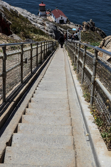
It's also 400 steps straight down from the top of the cliff. Which is fine going down. Until you go back up. Combined with the amount of people, I kind of felt like I needed a climbing rope and a carabiner to clip in and join the expedition to climb Mount Everest.
The views at the top of the point (coming back from the lighthouse) is exceptional, so we hung out there for a little while.
Then, we hopped back in the car one last time, and headed to our last destination of the day:
5. South Beach at Point Reyes
After forcing the kids to climb a thousand steps up from the lighthouse, we scrubbed another hiking trail on our agenda for another day, and drove down the point to the nearest beach, called South Beach, to let them play.
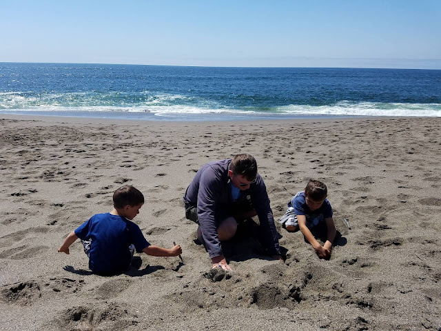
To make it clear: this is not a swimming beach. The shelf drops off dramatically just a few feet from shore, the waves are wicked, and the undertow is deadly. And there's sharks. So yeah. No swimmy swimmy, but the sand is nice and the view is awesome. We brought no beach toys (oops), but Cam dug a hole and Calen created a game with the tide and a stick, and we tossed the football around that we always keep in the truck. It was a nice way to relax after a busy day.
We stuck around for about an hour, then called it quits, took another round of Dramamine and drove home, getting back just in time to eat leftovers for dinner and watch Beetoven (1991 style, with Bonnie Hunt and that big St Bernard) as a family.
Super awesome day. If you're local, I highly recommend exploring this area, BUT, plan ahead, and make sure you download offline google maps of the area, because you will have ZERO cell phone reception.


